The year 2024 marked a distressing chapter in Earth’s climate history, setting numerous records for extreme weather conditions. July was particularly noteworthy, as it registered the highest average temperatures seen in at least 175 years. Within this month, July 22 became the hottest day on record, highlighting an unprecedented level of heat.
Furthermore, this summer was the hottest since approximately 1880, coinciding with the early onset of Hurricane Beryl—the earliest Category 4 hurricane documented. A report published in June confirmed that human-driven global warming is reaching alarming levels, raising urgent concerns among scientists and policymakers alike.
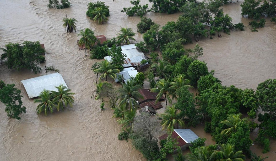
The implications of these rising temperatures are dire and multifaceted. Glaciers around the world are melting at unprecedented rates, contributing to irreversible sea-level rise that threatens coastal communities. This summer’s weather events, particularly Hurricane Helene, exemplified the dangerous interplay between climate change and extreme weather, leading to destruction and loss of life.
Additionally, wildlife is increasingly displaced from their natural habitats as changing climate conditions outpace their ability to adapt, jeopardizing biodiversity and ecosystems.

While the stark facts are unsettling, they serve to emphasize the necessity for immediate and effective action against climate change. Understanding the severity of the situation is essential, yet the challenge lies in converting this knowledge into actionable steps.
Policymakers must be persuaded to implement substantial changes in response to these crises, as the climate emergency is deeply enmeshed in political frameworks. The future of Earth relies on effective data communication, bridging the gap between scientific findings and public awareness.
Interestingly, space exploration has emerged as a critical ally in addressing climate challenges. Cedric David, a scientist at NASA’s Jet Propulsion Laboratory, emphasizes that understanding Earth’s interconnected systems is only possible through comprehensive observation from space.
This ongoing monitoring is akin to routine health check-ups, vital for diagnosing the current state of our planet and informing necessary interventions to mitigate further damage.
Climate satellites are essential tools in this observational effort. These satellites are specifically designed to collect data about various aspects of the Earth’s environment. For example, satellites equipped with spectrometers measure atmospheric carbon dioxide concentrations, while others capture images that reveal the extent of deforestation and shifting animal habitats.
This wealth of data is crucial for comprehending the impacts of human activities on the environment and the accelerating pace of climate change.
The utility of satellite data extends beyond long-term climate trends; it also has immediate, practical applications. Satellite systems play a pivotal role in assisting meteorologists with accurate storm predictions, an increasingly crucial task as climate change leads to more severe weather patterns.
The U.S. National Academies even recommended the establishment of the Earth System Observatory (ESO), a suite of satellites dedicated to continuous monitoring of Earth’s atmosphere and geology, thereby facilitating informed decision-making and climate action.
Despite the progress in satellite technology, significant challenges remain, particularly in accurately measuring snowpack from space. Understanding snow depth and density is vital for assessing freshwater resources in areas dependent on snowmelt.
David highlights radar altimetry data as a particularly valuable resource for illustrating the ongoing rise in sea levels, reinforcing the consensus that human actions are driving climate change. As exploration of the universe continues, the focus must remain on the pressing need to protect our planet, which remains the only home we have.

