
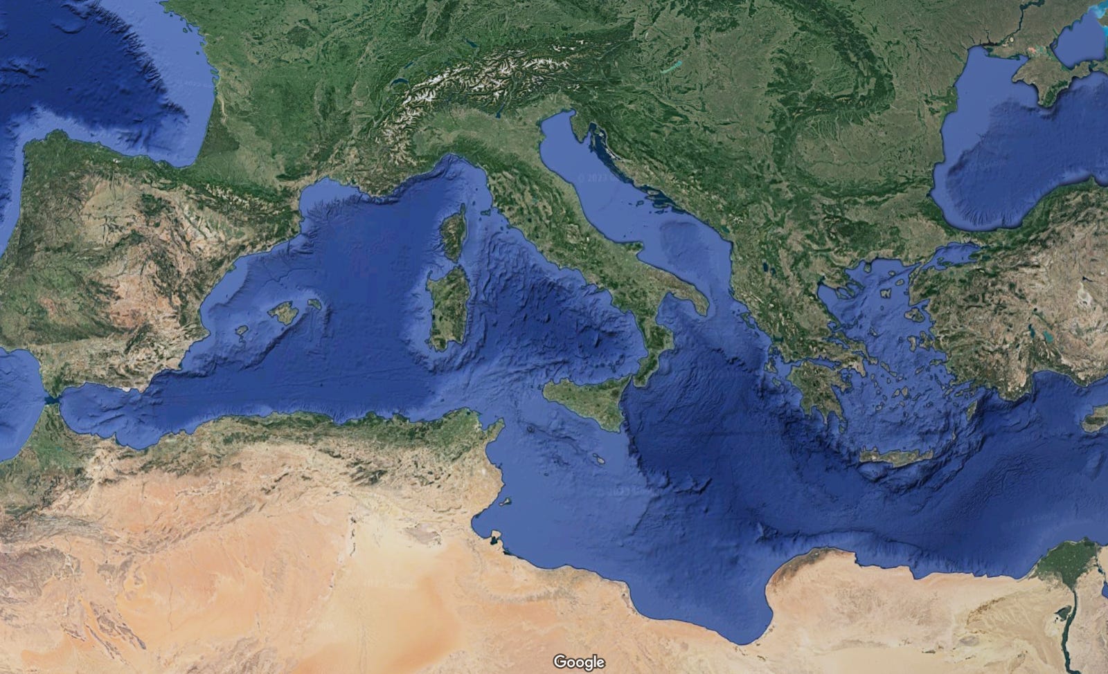
The Mediterranean Sea as we know it today owes its existence to what scientists believe was the most catastrophic flooding event in Earth’s recorded history. Around 5.3 million years ago, after the Mediterranean had largely dried up during a period known as the Messinian salinity crisis, Atlantic waters burst through the Strait of Gibraltar with unimaginable force.
This deluge, called the Zanclean megaflood, discharged water at rates 1,000 times greater than the modern Amazon River and completely refilled the Mediterranean basin in just a few years, possibly even months.
While evidence for this extraordinary event has been mounting since 2009, researchers have now discovered the first land-based proof of the megaflood’s passage: jumbled rock deposits scattered across hilltops in southeastern Sicily that tell the story of water moving faster than a speeding car across the ancient land.
Geological Detective Work Reveals Ancient Catastrophe
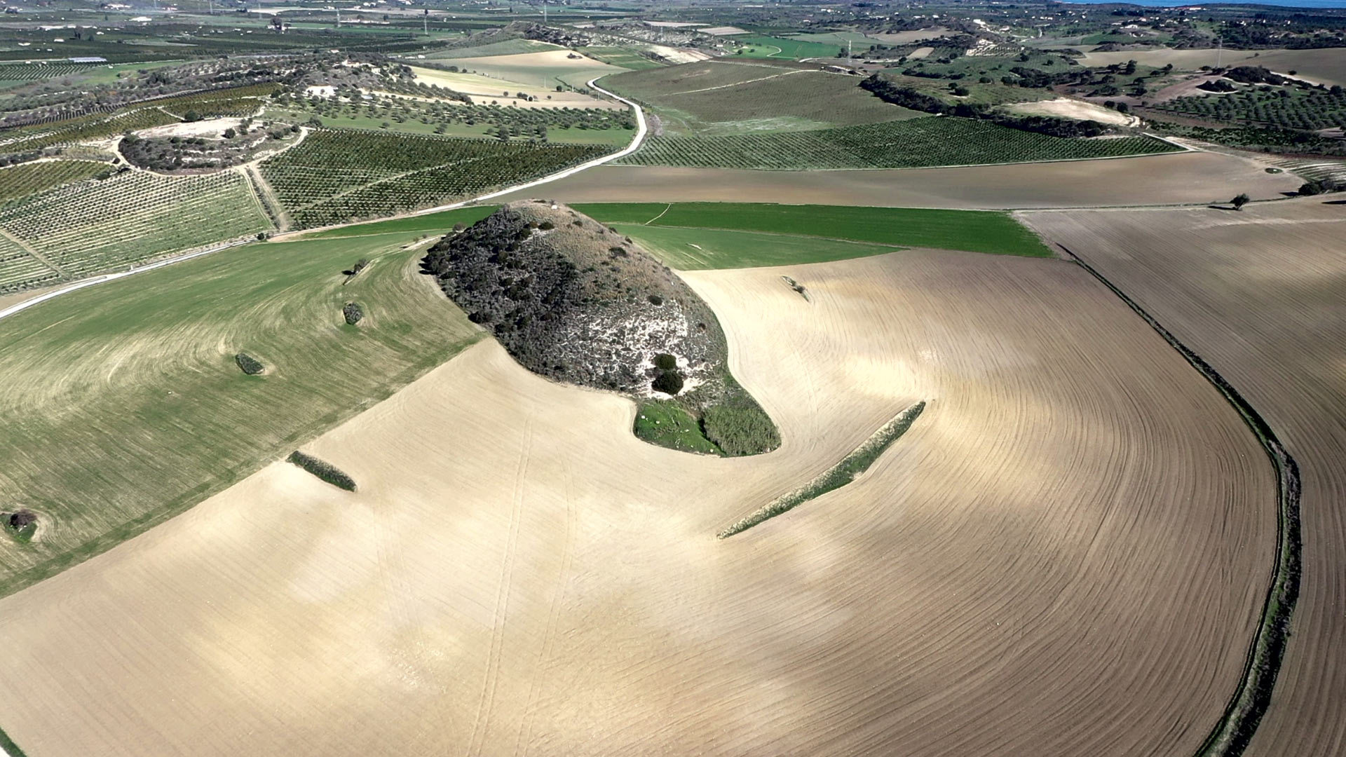
The breakthrough came through the keen observations of Giovanni Barreca from the University of Catania, who grew up in southeastern Sicily and had long been puzzled by the region’s unusual topography. The area features distinctive lozenge-shaped hills that all align in the same direction, separated by deeply eroded depressions—a land pattern that reminded researchers of similar formations in Washington State created by Ice Age megafloods.
When the international research team examined these Sicilian hills more closely, they made a remarkable discovery. Scattered across the hilltops were jumbled deposits of rock debris, including boulders, that didn’t belong there.
These rocks were identical to materials found in the depressions below and further inland, suggesting they had been violently transported upward and deposited by an enormous flow of water.
The positioning of these deposits provided crucial evidence that the hills themselves had been carved and shaped by the ancient megaflood as it surged from the western Mediterranean basin into the eastern basin through what was then known as the Sicily Sill—a shallow underwater ridge that connected Sicily to mainland Africa.
Reconstructing the ancient Deluge
To validate their findings, researchers developed sophisticated computer simulations to model how floodwaters would have behaved as they crossed the Sicily Sill. The results were staggering: the models showed that water would have been at least 40 meters deep while traveling at speeds of 115 kilometers per hour—fast enough to carve out the streamlined hills and deposit massive amounts of eroded material on their crests.
In the specific area they modeled, scientists calculated that 13 million cubic meters of water per second would have flooded into the eastern Mediterranean basin. To put this in perspective, the Amazon River today carries only about 200,000 cubic meters per second.
Yet even this tremendous flow represents just a fraction of the total water that initially poured through Gibraltar before reaching Sicily.
The research team also identified the Noto submarine canyon off southeastern Sicily as the most likely pathway for the cascading floodwaters into the deeper Ionian Basin. This canyon features a distinctive amphitheater-shaped head that spans 6 kilometers and resembles bedrock canyons rapidly carved by other known megafloods.
Evidence Buried Underneath the Seafloor
Supporting the land-based discoveries, previous research had already uncovered extensive evidence of the megaflood preserved in sedimentary layers beneath the Mediterranean seafloor. Scientists identified a massive body of chaotic sediments, dubbed “Unit 2,” buried in the subsurface of the Sicily Channel.
This sedimentary deposit, which can reach thicknesses of up to 860 meters in some areas, represents what researchers believe may be the largest known megaflood deposit on Earth.
These underwater sediments are positioned precisely where the geological timeline would predict: above salt layers formed during the Mediterranean’s dry period and below normal marine sediments deposited after the sea was refilled. The chaotic, jumbled nature of these deposits matches the characteristics typically seen in catastrophic flood sediments.
A Catastrophe That Reshaped the Ancient World
The Zanclean megaflood represents one of the most dramatic environmental changes since the extinction of the dinosaurs 65 million years ago. The event brought a swift and catastrophic end to the Messinian salinity crisis, during which tectonic movements had largely isolated the Mediterranean from the Atlantic Ocean, causing it to dry up and leaving behind massive salt deposits.
While the complete refilling of the Mediterranean may have taken between two and sixteen years, the main flooding event that carved Sicily’s land likely lasted only days. This research provides the most compelling evidence yet for an event that fundamentally reshaped one of the world’s most important bodies of water, demonstrating how geological catastrophes can dramatically alter Earth’s surface in remarkably short periods.