
The Mediterranean and northern Europe experienced dramatically contrasting weather patterns in late March and early April 2025, with devastating storms wreaking havoc across Greek islands while record-breaking dry conditions dominated much of northwestern Europe.
The stark meteorological divide highlighted the increasingly volatile nature of European weather systems, as popular Aegean destinations faced catastrophic flooding just as countries like the Netherlands, Belgium, and the United Kingdom celebrated their sunniest March in decades.
These extreme conditions occurred during what should have been the transition into the spring tourism season, creating significant challenges for Greek island communities while northern European regions grappled with drought concerns and elevated fire risks due to prolonged dry spells.
Cycladic Islands Bear Brunt of Torrential Downpours
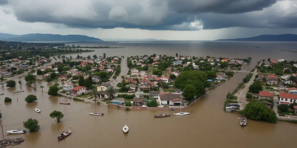
The Cyclades archipelago became the epicenter of meteorological chaos when powerful thunderstorms unleashed unprecedented rainfall across the region. Paros and Mykonos, two of Greece’s most beloved tourist destinations, received an entire month’s worth of precipitation within a mere three-hour window. The intensity of the rainfall overwhelmed the islands’ drainage systems, transforming picturesque streets into raging torrents that swept everything in their path.
In Naoussa, Paros, the scenes were particularly dramatic as streets became rivers, carrying dozens of vehicles, motorcycles, and debris toward the sea. The sheer force of the rushing water broke protective railings in popular tourist areas, trapping cars on bridges while dragging others directly into the Mediterranean. Emergency crews worked tirelessly to rescue stranded residents, successfully assisting 13 people without any reported fatalities.
Mykonos experienced similar chaos, though slightly less severe, with excavators deployed to redirect floodwaters away from seafront restaurants and businesses. The storm’s impact extended beyond immediate flooding, as hailstorms accompanied the torrential rain, covering fields with ice pellets and adding to the destruction.
Emergency Response and Infrastructure Damage
Greek authorities responded swiftly to the crisis, implementing comprehensive emergency measures across affected islands. Both Paros and Mykonos were officially declared in states of emergency, with the designation remaining in effect until April 30, 2025. Schools across multiple islands, including Rhodes, Kalymnos, Symi, and Tilos, were closed as a precautionary measure.
Transportation networks suffered significant disruption, with ferry services halted and road access restricted to emergency vehicles only. The storms caused substantial infrastructure damage, prompting local authorities to request emergency government assistance for road repairs and debris removal. Municipal crews, supported by firefighters from neighboring islands, worked around the clock to clear mud, rocks, and scattered debris from affected areas.
The meteorological explanation for this extreme weather involved a “nearly stationary storm cluster” over the Cyclades, with private weather stations recording over 100 tons of rainfall per 1,000 square meters in elevated areas of Paros6. This water subsequently flowed down natural drainage paths into coastal towns, effectively transforming urban areas into temporary rivers.
Crete and Eastern Islands Face Secondary Wave
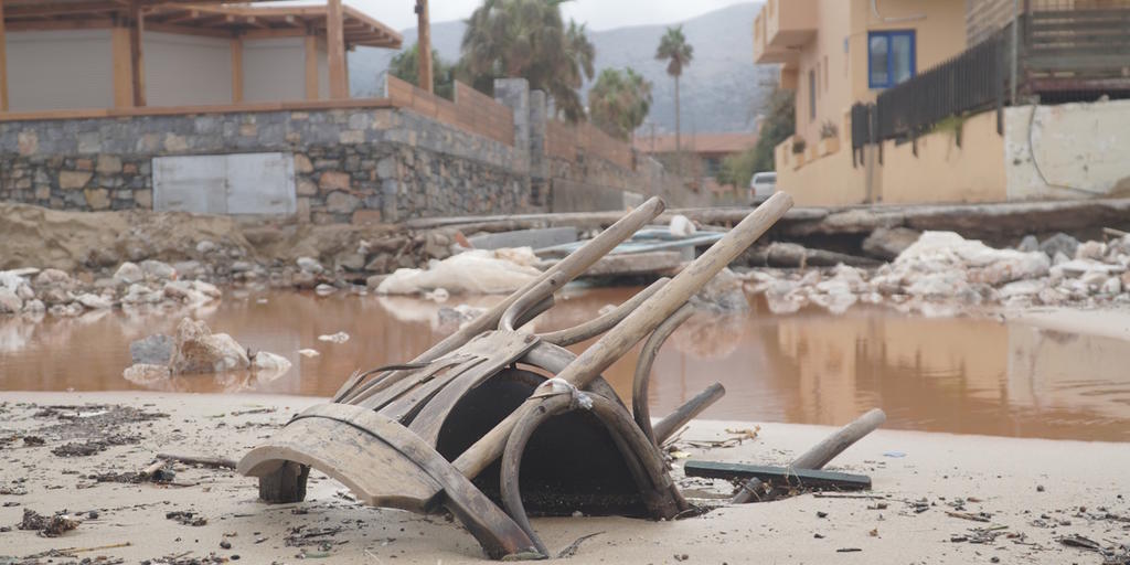
As the storm system moved southeast, Crete became the next target for severe weather conditions. The port city of Chania recorded the highest 24-hour rainfall totals, leading to widespread flooding and requiring rescue operations for seven people trapped in vehicles. Landslides and road closures were reported across the island as the storm’s intensity continued.
Rhodes also experienced significant impacts from gale-force winds that toppled trees and damaged vehicles, while other eastern Aegean islands near the Turkish coast faced heavy rainfall and flooding. The National Observatory of Athens confirmed that this weather event represented one of the most severe storm systems to impact the region in recent years.
Record-Breaking Drought Conditions Across Northern Europe
While Greek islands battled devastating floods, northwestern Europe experienced the opposite extreme with record-breaking dry conditions. The Netherlands recorded an exceptional 248 hours of sunshine at the De Bilt weather station, surpassing the previous record set in 2022 and nearly doubling the March average. Rainfall averaged just 5 millimeters nationwide, representing less than 10% of typical March precipitation.
Belgium similarly experienced extraordinary conditions, with Brussels recording only 7.8 millimeters of rain—just 10% of the March average—making it the third-driest March in a century. The country also enjoyed 191 hours of sunshine, 50% above normal levels, accompanied by unusually warm daytime temperatures averaging 13.6°C compared to the typical 10.9°C.
England and Wales recorded their driest March since at least 1961, with some regions experiencing their sunniest March on record. East Anglia particularly benefited from exceptional sunshine hours, while areas like Suffolk and Norfolk saw their second-driest March since records began. The prolonged dry conditions raised concerns about fire risks across extensive parts of England.
Climate Implications and Future Outlook
The contrasting weather patterns highlighted the increasing volatility of European climate systems, with experts attributing the Greek storms primarily to human-driven climate change. The extreme precipitation events occurred against a backdrop of rising sea temperatures, which have been linked to more frequent and severe flooding incidents across Greece in recent years.
High-pressure systems dominated northern Europe throughout March, creating stable weather patterns that brought abundant sunshine but critically low rainfall. These conditions were expected to persist into April, with forecasters predicting continued dry weather across the Netherlands, Belgium, the United Kingdom, and Ireland for at least the first ten days of the month.
The dramatic weather divide between Mediterranean flooding and northern European drought underscored the complex challenges facing European communities as climate patterns become increasingly unpredictable and extreme.