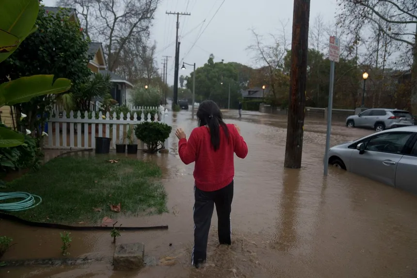
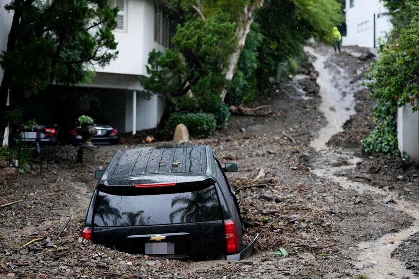
California is bracing for more torrential rainfall next week as the state continues to grapple with the effects of a very wet start to the year. The relentless downpours have already caused rivers and streams to overflow, sending cascades down streets and highways, and submerging vehicles, homes, and businesses. As the storm surge pummels the state’s saturated soils and waterlogged systems, experts warn that the pattern is set to continue and intensify.
The warm Pacific waters have unleashed a series of atmospheric rivers, designated by meteorologists as ARs, which carry an enormous amount of water vapor from the tropics. “Rivers in the sky” is how the National Oceanic and Atmospheric Administration puts it. These ARs are an essential part of California’s climate, bringing roughly half of the state’s annual precipitation. However, they can also be destructive, often accompanied by strong gusty winds.
The Pineapple express is a particularly powerful phenomenon, delivering moisture from around Hawaii to the west coast, resulting in rain and snow that can be devastating. These systems, combined with bomb cyclones, have created the perfect storm in California, plunging the state into a soggy nightmare. A bomb cyclone, said Alex Lamers, warning coordination meteorologist for the National Weather Service Weather Prediction Center, is a storm whose pressure is falling rapidly, quickly strengthening. This type of system can generate the worst weather at its edges.

As California tries to recover from the latest deluge, scientists are warning that this is a glimpse of what’s to come with a warming world. The climate crisis is expected to intensify weather extremes, making shifts from wet to dry, and dry to wet, more severe. The destructive set of storms is consistent with what climate models have been predicting, said Dr. Marty Ralph, director of the Center for Western Weather and Water Extremes and a researcher at Scripps Institution of Oceanography. Climate change is supercharging the storms by making more water vapor available, creating more rain and snow.
The La Niña climate pattern, characterized by a colder-than-average sea surface level in the Pacific ocean near the equator, is also playing a role in the wet conditions. However, as Lamers points out, this pattern is not a guarantee of a particular type of weather. The presence of strong storms also doesn’t necessarily mean the wet trend will continue through the winter.
As California navigates this unseasonable wet spell, residents are left wondering what the future holds. Will the state continue to receive heavy rainfall, or will it return to its typical dry self? One thing is certain – the climate crisis is paving the way for more extreme weather events, and California is at the forefront of that battle.

