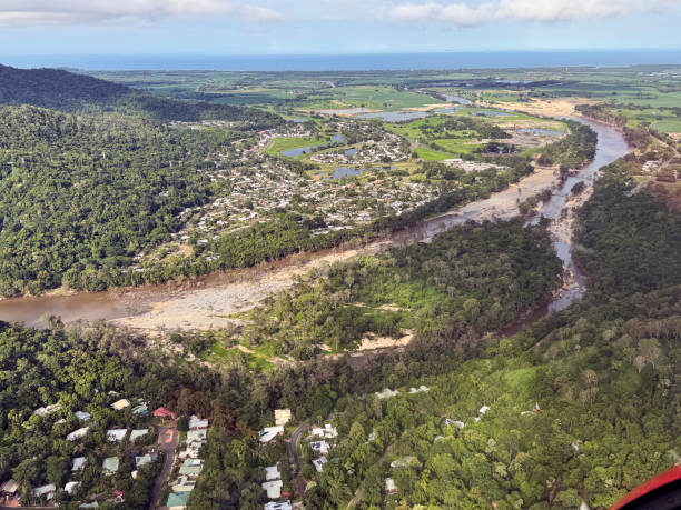
On December 5, a storm system formed around the Solomon Islands, eventually developing into the first tropical cyclone of Australia’s season. Cyclone Jasper made landfall just north of Port Douglas on December 13 as a category two cyclone.
It took nearly five days for Jasper to traverse Queensland, leaving behind widespread devastation, with many regions recording over a meter of rainfall.
The notable aspect of Cyclone Jasper was not its intensity, but its slow progression and the extraordinary rainfall it produced. Experts suggest that the cyclone’s slow movement allowed it to drop significantly more rain in concentrated areas compared to faster-moving systems.
Prof. Michael Reeder from Monash University noted that European climate models had predicted the potential for a cyclone in the Coral Sea in late November, with models accurately forecasting its landfall timing.

Dr. Andrew Dowdy from the University of Melbourne explained that the cyclone’s slow movement allowed for more intense rainfall over specific regions, which can lead to severe flooding. This phenomenon is partly due to “steering winds” high in the atmosphere that guide the cyclone’s path.
Additionally, Dr. Hamish Ramsay from CSIRO highlighted “topographic enhancement” as a factor that intensified the rainfall, with the hilly terrain around Cairns contributing to increased moisture lift.
As of Monday, major flood warnings were in place for several rivers in north Queensland, with the Daintree River reaching a peak of 15 meters—over 2 meters above the previous record.
The Bureau of Meteorology forecasts that the cyclone remnants might move northwest into the Gulf of Carpentaria, with a low chance of reforming into a tropical cyclone.
Regarding climate change, scientists are assessing its role in the cyclone’s intensity. Dr. Jaci Brown from CSIRO noted that while El Niño typically reduces cyclone frequency, the current climate regime is unusual. Climate models suggest that increased global warming could lead to more intense rainfall from cyclones.
Dr. Andrew King from the University of Melbourne indicated that elevated sea surface temperatures likely contributed to the cyclone’s severity, with each degree of global warming potentially increasing rainfall by up to 15%.

