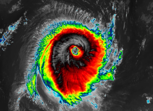
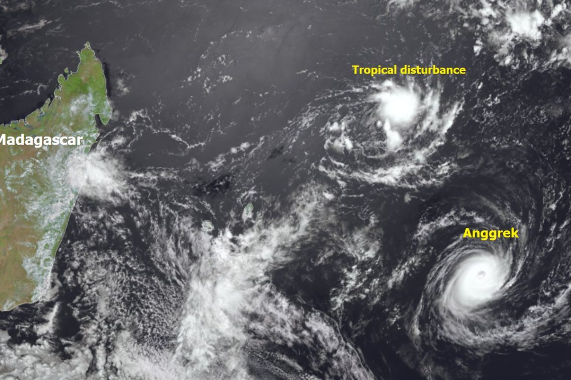
Over the past week, a powerful tropical cyclone has developed, with winds reaching 120 mph. Originating off the west coast of the Cocos Islands, the cyclone has been moving southwest across the Indian Ocean.
Named Anggrek by the Jakarta Tropical Cyclone Warning Centre, it is not expected to make landfall but will weaken as it circulates in the central Indian Ocean later this week.
In the eastern US, a series of winter storms last week caused significant damage with extreme snowfall. Now, the western US is bracing for heavy rain as a deepening low-pressure system moves in from the Atlantic. Northwestern California is anticipated to experience the heaviest rainfall, with over 100mm possible on Wednesday.
This phenomenon, known as atmospheric rivers, often brings substantial moisture from the tropical Pacific. One well-known example is the “Pineapple Express,” which transports warm, moist air from near Hawaii.

As this moist air reaches the US west coast, it causes heavy rain and snow, particularly over the Sierra Nevada.
Western Canada will also face flooding linked to atmospheric rivers, with Vancouver Island expecting over 200mm of rain over several days.
These atmospheric rivers are likely intensified by the ongoing El Niño, which boosts moisture levels due to warmer Pacific temperatures. While they can cause severe flooding, they also provide essential water to drought-stricken regions.
In Spain, a recent heatwave led to some of the highest January temperatures ever recorded, nearing 30°C, about 10°C above average. Although the heatwave is expected to weaken this week, temperatures will remain above average.
Similarly, Canada and northern US areas, after enduring severe cold in January, are expected to see above-average temperatures toward the end of this month and into early February.

