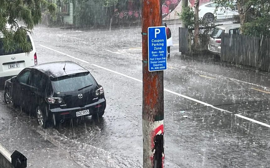
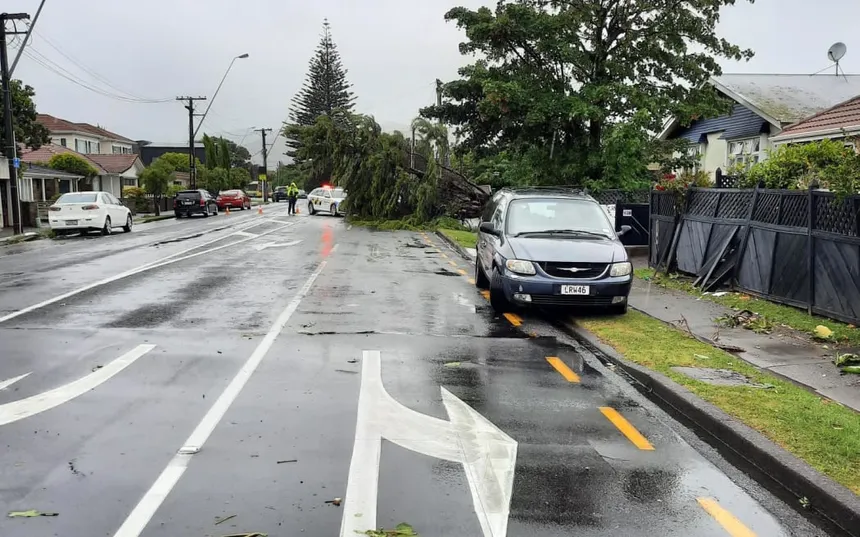
Stormy weather has engulfed parts of Australia this week, driven by tropical moisture and low-pressure troughs. The intense storms and heavy rain have left thousands without power in Geelong and the Bellarine peninsula in Victoria, while lightning has lit up the skies in New South Wales. In a dramatic display, Greg Bourke, a Twitter user, captured a lightning storm over the Sydney basin, visible from Bilpin in the Blue Mountains.
The forecast from Ben Domensino, a Weatherzone meteorologist, predicts widespread and locally heavy rain across the country this week. He explains that the rainfall is a result of daily shower and thunderstorm activity, fueled by tropical moisture and low-pressure systems. Domensino notes that thunderstorms require three key components: high moisture in the atmosphere, an unstable atmosphere, and a trigger that lifts air up vertically.
Why are storms more common in summer? Thunderstorms thrive in warm, humid air, which is abundant during the summer months. September to March is the peak storm season, with the Bureau of Meteorology attributing this to the tropical north of Australia. The perfect combination of high moisture levels, warm air temperatures, and a trigger, such as a front or low-pressure trough, sets the stage for thunderstorms to develop.
Researchers from the Bureau of Meteorology identify three essential elements for thunderstorm formation: high moisture, atmospheric instability, and a trigger that lifts air vertically. In the summer, the tropical north of Australia is particularly conducive to thunderstorm development, with high moisture levels and low-pressure systems prevailing.
 Australia’s Wild Weather Wreaks Havoc This Week
Climate change has a significant impact on thunderstorms, with daily rainfall totals increasing since 1979, especially in the northern parts of the country. The CSIRO’s 2022 state of the environment report finds that intense storms with higher rainfall are becoming more frequent. Future projections suggest that Australia will experience fewer tropical cyclones but more intense storms.

Rapid storm-related extreme rainfall events may intensify at an even higher rate, according to the Earth Systems and Climate Change Hub. The additional moisture in the atmosphere could cause more intense convection, leading to higher rainfall intensity. Historical analysis by the Bureau of Meteorology finds no consistent link between El Niño or La Niña events and thunderstorm frequency, but notes that less frequent thunderstorms were observed in south-eastern Australia during strong El Niño years.
As the stormy weather continues to batter parts of Australia, the implications of climate change on thunderstorms are becoming increasingly clear. With higher rainfall totals, more intense storms, and a greater proportion of high-intensity storms, it’s essential to understand and prepare for the changing weather patterns.