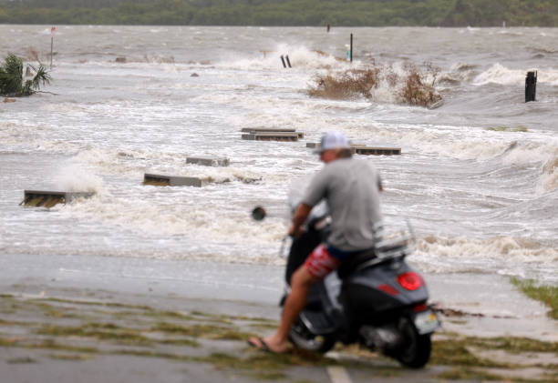
Significant weather developments are occurring across several regions. Tropical Storm Debby, which formed over the weekend in the eastern Gulf of Mexico, is currently tracking northward along the west coast of Florida.
Forecast models predict that Debby is likely to escalate into at least a Category 1 hurricane before making landfall on Monday, with sustained winds expected to exceed 75 mph.
As the storm moves over the exceptionally warm waters off western Florida, there is potential for further strengthening.
The eye of the hurricane is forecasted to make landfall near the Florida Big Bend region, progressing through northern Florida and into Georgia.
The storm will then continue its path into the eastern Carolinas and eventually the Atlantic Ocean by Tuesday and Wednesday.

Residents in coastal Florida are under storm surge warnings, and the storm’s heavy rains could lead to flooding with totals surpassing 10-20 inches (250-500 mm) in northern Florida, southeastern Georgia, and South Carolina.
In Japan, a severe heatwave has gripped the nation, with temperatures reaching the high 30s Celsius in many regions. Last Sunday, Kyushu recorded temperatures approaching 40°C.
Despite the extreme daytime heat, nighttime temperatures have remained unusually high, not dipping below the mid-20s Celsius. Although the intense heat is expected to persist for a few more days, a cooling trend is anticipated to begin later this week.
In Europe, a large low-pressure system over the northeastern Atlantic has brought cooler conditions to northern regions, following a period of heat.
This drop in temperature has likely been a relief during the ongoing Olympics in France. However, warmer weather is expected to return to Paris, with temperatures nearing 30°C later this week.
The final weekend of the Olympics could face potential thunderstorms, adding a dynamic element to the closing ceremonies.

