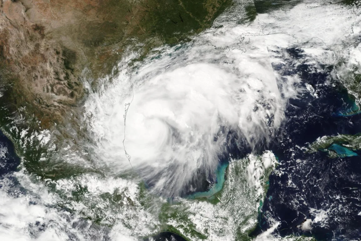
Following Hurricane Francine, which is currently dissipating over the Tennessee Valley, the weather activity is now focusing on an old frontal boundary off the Southeast coast that could potentially develop into the next tropical disturbance of the season.
The National Hurricane Center (NHC) has given this area a medium chance of development over the coming week. Regardless of whether it becomes a tropical cyclone, the Carolinas should expect rainy and occasionally windy conditions throughout the weekend and into the first half of the workweek.
While environmental conditions are not highly favorable for rapid intensification, the disturbance could gradually organize as it moves northward and westward toward the coastline.
The mid-Atlantic and Carolinas will experience persistent onshore flow, and the impact is expected to be consistent, even if the system doesn’t develop into a cyclone.
Forecasts predict a broad area of 2-5 inches of rain, with locally heavier amounts possible, especially east of Interstate 95, affecting coastal areas like Myrtle Beach in South Carolina, and Wilmington and Morehead City in North Carolina.
The National Oceanic and Atmospheric Administration (NOAA) Weather Prediction Center has identified the Carolina coast as an area of concern for potential flooding on Monday. More moderate rainfall totals are anticipated for inland areas, including Raleigh, Charlotte, and Richmond, Virginia.
The disturbance will also lead to rough ocean conditions, increasing the threat of rip currents and coastal erosion.
The Outer Banks of North Carolina and southeast Virginia, already prone to rough seas, will feel these effects, as seen recently with swells generated by Hurricane Ernesto, which was over 1,000 miles away.
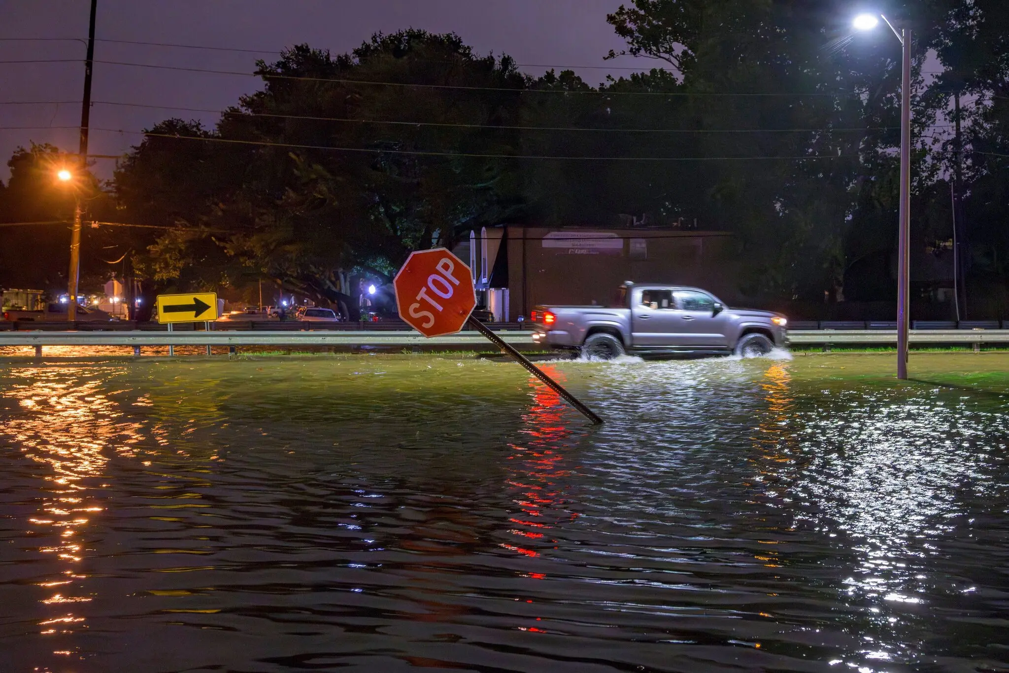 Floods in New Orleans (Photo: Matthew Hinton)
Waves from Ernesto, once a Category 2 hurricane, caused flooding on North Carolina Highway 12, the main road through the Outer Banks. In one case, an abandoned home collapsed into the ocean due to the severe erosion.
Following this incident, parts of the Cape Hatteras National Seashore were closed to swimmers over concerns about debris in the water.
Although there is no indication that current surf conditions will surpass Ernesto’s swells or lead to further home collapses, the local National Weather Service office in Morehead City, North Carolina, has issued advisories warning beachgoers and boaters of hazardous conditions.
Elsewhere in the Atlantic basin, the NHC is tracking two additional systems, but neither currently poses a significant threat to land.
The first is a system designated as Invest 94L, a cluster of showers and thunderstorms nearing the northern Leeward Islands. Though it will likely bring rain to the area, strong wind shear and dry air are expected to inhibit its development into a more organized system.
The second system under observation is Tropical Storm Gordon, currently located about halfway between the Caribbean and Africa.
Throughout its projected path, Gordon is expected to remain over open water and not impact any land.
As for naming conventions, the next tropical storm to form will officially be designated as “Gordon.” Typically, the seventh named storm of the Atlantic hurricane season occurs around September 3, indicating that the 2024 season is slightly behind the average in terms of total named storms.