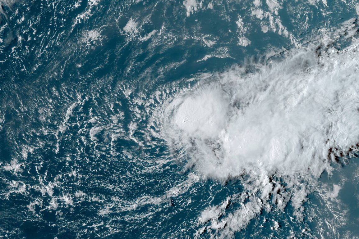
Tropical Storm Gordon is currently being monitored as it moves across the central tropical Atlantic, but it is expected to weaken in the coming days. Located about 1,145 miles west-northwest of the Cabo Verde Islands, the storm has sustained winds of 45 mph and is moving at about 9 mph.
Gordon is predicted to become a depression by Sunday and could regain some strength later in the week, though it is not expected to pose a threat to land for at least the next week.
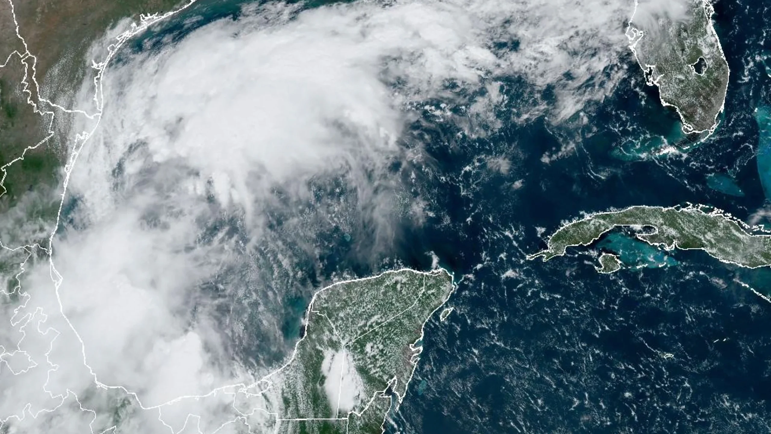
Another disturbance is developing off the Southeast U.S. coast, which could bring heavy rain, coastal flooding, and beach erosion to areas from northeastern Florida to the Delmarva Peninsula. This system may strengthen into a tropical disturbance or storm early next week.
The storm’s impact could coincide with lingering effects from the remnants of Hurricane Francine, which has already caused significant rain and flooding across the Southeast.
 Tropical Storm Gordon Weakens as New Disturbance Develops Off Southeast U.S. Coast
Post-tropical storm Francine continues to affect the Southeast U.S., bringing heavy rain and flash flood risks to several states, including Arkansas, Tennessee, Mississippi, Alabama, and Georgia. These areas are under flash flood watches through Sunday, as the region is expected to see continued rainfall over the weekend. Francine’s remnants will contribute to the overall threat of flooding in the affected regions.
The National Hurricane Center (NHC) is closely watching the system off the Southeast U.S. coast, which has a 30% chance of developing into a tropical depression or storm in the next 48 hours and a 50% chance over the next week.

As the system moves north, it will bring thunderstorms, heavy rain, and potential flash flooding to Florida, the Carolinas, and the Mid-Atlantic through early next week. The warm waters of the Gulf Stream could help fuel the development of this system as it progresses.
In addition to these systems, the NHC is monitoring three other tropical waves. One is located in the eastern Atlantic, another is moving across the Lesser Antilles, and the third is in the central Caribbean near western Venezuela. These tropical waves could potentially develop into tropical cyclones, which could later strengthen into storms or hurricanes.