As meteorological autumn came to a close last week, parts of the north-east United States experienced substantial snowfall due to a weather phenomenon known as “lake-effect snow.”
This occurs when cold air passes over warmer lake waters, causing a moist, heated layer of air to rise and condense, forming clouds that release snow in localized bands.
Conditions in the Great Lakes region were ideal for lake-effect snow over the weekend.
A low-pressure system over eastern Canada allowed Arctic air to sweep across the lakes, resulting in heavy snowfall in five states downwind of Lake Ontario, Lake Michigan, and Lake Erie.
Western New York was particularly impacted, with nearly 4 feet of snow accumulating in just four days.
As a result, New York and Pennsylvania declared states of emergency, deploying National Guard troops to rescue drivers trapped during post-Thanksgiving travel.
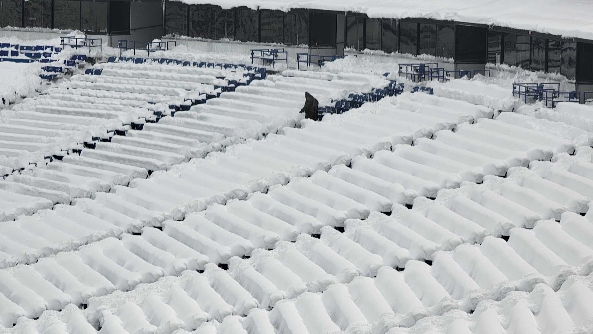
In Buffalo, New York, volunteers helped clear snow from Highmark Stadium in preparation for the Sunday night game between the Buffalo Bills and the San Francisco 49ers.

This was a clear indication of the intensity of the storm, as snow continued to accumulate in the region.
By the start of this week, up to 6 feet of snow were forecast for upstate New York, while colder temperatures spread across the eastern U.S., with some areas expecting temperatures 10-15°F below average.
Snow Causes Chaos in Seoul
Snow has also caused major disruptions in South Korea, where the capital, Seoul, saw its third heaviest snowfall on record.
Last Wednesday, more than 40 cm (16 inches) of snow fell, marking the heaviest November snowfall since records began a century ago.
The storm led to the cancellation of 142 flights and 76 ferry routes, as well as the closure of over 1,000 schools in the Gyeonggi province.
Tragically, the snowfall contributed to the deaths of five people, four due to collapsing structures and one in a traffic accident.
Despite the severe conditions, temperatures have since risen, melting much of the snow by Sunday.

