The Pacific Ocean is currently witnessing a surge in meteorological activity, marked by the simultaneous presence of two hurricanes in the northeast and a powerful typhoon in the northwest. The convergence of these intense weather systems underscores the region’s volatility, with potential impacts ranging from turbulent seas to significant rainfall and strong winds.
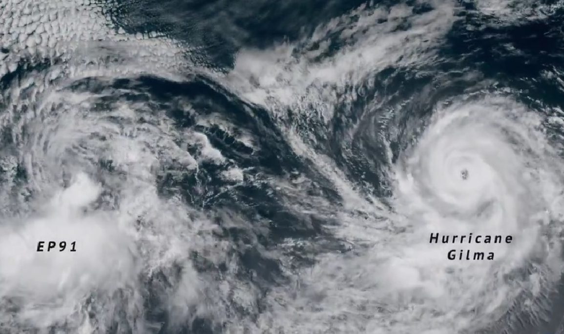
Hurricane Gilma’s Rapid Intensification
Hurricane Gilma rapidly intensified into a formidable Category 4 storm on Sunday as it moved westward across the Pacific. With sustained winds reaching up to 130 mph and generating 3.5-meter-high swells, Gilma created hazardous conditions for marine vessels throughout the weekend.
Despite its strength, Gilma’s path spared any significant landfall, reducing the threat of widespread damage. However, the turbulent sea conditions it caused were notable.
Looking ahead, Gilma is expected to approach the Hawaiian archipelago, passing to the north of the islands by Friday. By then, the storm is likely to have weakened into a remnant low-pressure system, minimizing any potential for destruction.
Hurricane Hone’s Impact on Hawai’i
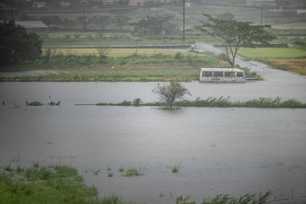
In contrast, Hurricane Hone made a more direct impact on the Hawaiian islands this weekend. Passing just 50 nautical miles south of Hawai’i’s Big Island, Hone, a Category 1 hurricane, brought sustained winds nearing 80 mph and generated strong breaking waves up to 4.3 meters high.
 Typhoon Shanshan nears Japan with 125mph winds, raising concerns of flash floods and landslides
The eastern windward side of the island faced the brunt of the storm, with weather stations reporting significant rainfall—110 mm within just six hours from Saturday night.
By Sunday, some areas recorded up to 350 mm, nearly triple the average monthly precipitation for August. While Hone’s effects were severe, including the risk of flash flooding and landslides, the storm is expected to weaken as it moves westward on Monday.
Typhoon Shanshan Approaches Japan

Meanwhile, in the northwest Pacific, Typhoon Shanshan is advancing toward southern Japan. On Sunday, the storm recorded sustained winds of 75 mph, with gusts reaching 110 mph.
Shanshan is anticipated to intensify further, potentially achieving very strong typhoon status by Tuesday, with maximum wind speeds projected to reach 125 mph.
This powerful storm poses a serious threat to Japan’s infrastructure, particularly in mountainous regions where heavy rainfall—forecasted to exceed 300 mm within 24 hours—could trigger flash flooding and landslides.
As these three storms continue to evolve, their impacts will be closely monitored, with communities in affected areas urged to remain vigilant.