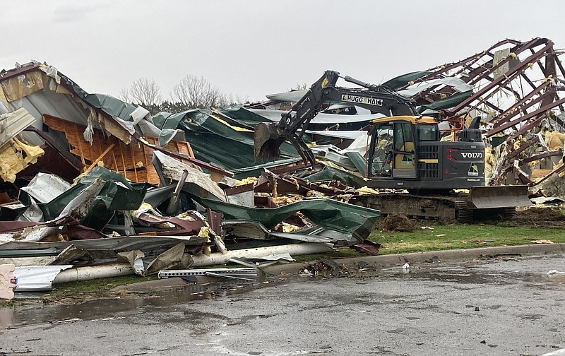
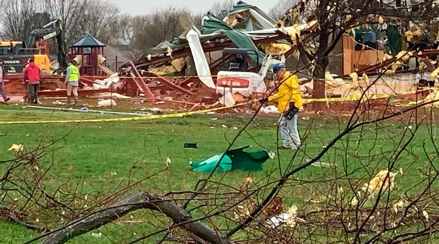
Severe winds caused significant damage to Jessieville School in Arkansas on Monday while classes were in session, amid a weather system with potential tornado activity, according to officials. Fortunately, no injuries were reported in the incident that occurred around 2:44 p.m. and was initially believed to be a tornado, as stated by the Garland County Sheriff’s Office.
The National Weather Service is working to confirm whether the event was indeed a tornado through storm survey teams. This incident took place in Jessieville, a community located approximately 45 miles west of Little Rock, amidst tornado watches affecting roughly 6 million people across Arkansas, Louisiana, Oklahoma, and Texas.
In addition to the severe weather in the South, a winter storm was moving across the central Plains and Upper Midwest, bringing heavy snow, sleet, and freezing rain.
The storm was predicted to produce significant snowfall as it moved from the Central High Plains towards the Great Lakes, with expected heavy snow, sleet, and freezing rain by Tuesday.
The National Weather Service indicated that snow rates could reach 1-2 inches per hour in southern South Dakota and far southwest Minnesota, potentially leading to more than 12 inches of snow accumulation from the Nebraska Panhandle through southwest Minnesota.
 Millions at Risk Amid Tornado Threats and Winter Storms Across Central and Southern U.S.
Strong winds accompanying the storm were expected to cause blowing and drifting snow, creating hazardous travel conditions by reducing visibility and covering roads. In North Platte, Nebraska, a quarter-inch of ice had already accumulated by Monday afternoon, with predictions of up to 2 feet of snow in the Ainsworth area.

Moisture from the Western Gulf of Mexico was forecasted to move northward, causing showers and severe thunderstorms across the Lower Mississippi Valley. The thunderstorms were expected to bring frequent lightning, severe winds, hail, and a few tornadoes, with a slight risk of excessive rainfall leading to localized flash flooding in urban areas, roads, and small streams.
By Monday evening, parts of east Texas, southeastern Oklahoma, Arkansas, and northern Louisiana were at enhanced risk for severe thunderstorms. Nearly 19 million people were in areas at risk for tornadoes, damaging winds, flooding, and hail, with flood watches in effect through Monday night.
Severe storms were expected to continue eastward on Tuesday, affecting the Tennessee Valley and central Gulf Coast, following a historic blizzard that recently left dozens dead in New York’s Erie County, particularly Buffalo.