Hurricane Beryl’s explosive growth into an unprecedented early storm has left forecasters and scientists stunned. Beryl’s record-breaking intensity has caught many off guard, and experts are not just concerned about the immediate impact of the storm but also about the potential for more intense tropical systems in the coming months.
The storm’s rapid intensification from a depression to a category 4 hurricane in just 48 hours is eerily reminiscent of the monsters that form during the peak of hurricane season. Water temperatures in the Atlantic and Caribbean are abnormally hot, with temperatures in some areas reaching 2-3.6 degrees Fahrenheit above normal. This unusual warmth is providing the perfect fuel for the development of powerful storms.
“It’s like a nightmare come true,” said University of Miami tropical weather researcher Brian McNoldy. “Not only are we seeing storms form and intensify earlier, but they’re also becoming stronger and more prone to rapid intensification. This won’t be the last time we see something like this.”
Beryl’s unprecedented growth has shattered multiple records, including becoming the earliest category 4 and 5 hurricane on record. Its winds reached speeds of over 150mph, making it a monstrous storm. “Beryl is unprecedentedly strange,” said Weather Underground co-founder Jeff Masters. “It’s so far outside the climatology that you look at it and you say: ‘How did this happen in June?'”
Sea surface temperatures in the Atlantic and Caribbean are not just hot; they’re also above what’s typical for the peak of hurricane season in September. The ocean heat content, which measures deeper water that storms need to power up, is also at record levels for this time of year. These conditions are creating a perfect storm for intense tropical systems.
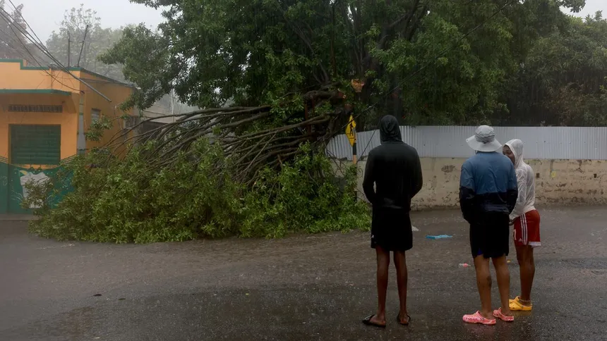
 Effects of Hurricane Beryl
“This year, everything is lining up just right for these massive storms to form,” said Colorado State University hurricane researcher Phil Klotzbach. “Beryl is a harbinger potentially of even more potential threats and more – and not just a one-off – maybe several of these kinds of storms coming down later.”

Scientists are still debating the impact of climate change on hurricanes, but most agree that it’s leading to more rapid intensification and stronger storms. “The Atlantic relative to the rest of the tropics is as warm as I’ve seen,” said MIT hurricane expert Kerry Emanuel. “The faster the ocean warms, the more prone we are to see these intense storms.”
As Hurricane Beryl continues its destructive path, forecasters are warning that this won’t be the last of these intense tropical systems. “We’re starting early, and some very severe storms are on the horizon,” said University at Albany atmospheric scientist Kristen Corbosiero. “Unfortunately, it seems like it’s playing out the way we anticipated.”