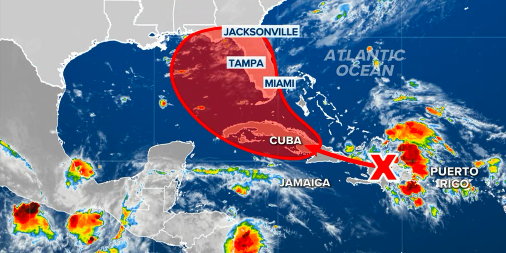
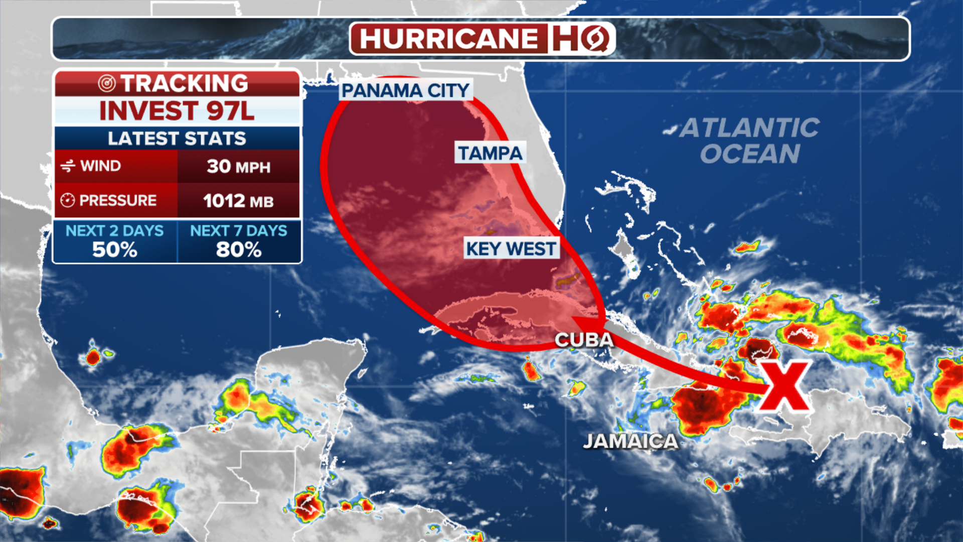
As July transitions into August, tropical activity in the Atlantic typically increases. Currently, a significant tropical wave known as Invest 97L, located near Haiti, is expected to move towards the southeastern Gulf of Mexico over the weekend.
This system has the potential to develop into Tropical Storm Debby, the fourth named storm of the year. While its future remains uncertain, models suggest it could become a long-lasting, slow-moving tropical storm or hurricane, bringing substantial rainfall to parts of the eastern Gulf Coast. There is also a possibility that it could track closely along the Southeast U.S. coast.
On Thursday, Invest 97L was causing heavy rainfall over Hispaniola, the southeastern Bahamas, and nearby regions. However, the system has struggled to organize due to the presence of dry air, which has limited the development of more coherent thunderstorms.
The mid-level humidity in the area was around 55%, although conditions otherwise were favorable, with light to moderate wind shear and very warm sea surface temperatures of 29 degrees Celsius (84°F) that typically support tropical development.
 Tropical Wave Invest 97L Nears Southeastern Gulf with Potential to Become Tropical Storm Debby
According to the National Hurricane Center’s Tropical Weather Outlook issued at 2 p.m. EDT Thursday, there is a 30% chance that Invest 97L will become a tropical depression by Saturday and a 70% chance by the following Thursday. These probabilities are expected to increase as the system approaches the weekend. A hurricane-hunter flight is scheduled to investigate 97L on Friday afternoon to gather more information.
The movement of 97L will be influenced by three main systems to its north: a strong ridge of high pressure across the U.S., another ridge in the Atlantic associated with the Azores-Bermuda High, and a trough of low pressure.
Initially, 97L will be directed west-northwest by the Atlantic ridge, moving along the length of Cuba. As it progresses, the system will encounter a moister environment and less land interaction, potentially aiding its development into a tropical storm or depression.

There are two primary forecast scenarios for 97L. In the first scenario, if the system develops quickly and moves north, it could be pulled towards Florida’s Gulf Coast and then along the Southeast U.S. coast, causing heavy rains and high seas. The second scenario suggests that if 97L intensifies more slowly and remains further south, it could get trapped in the Gulf of Mexico, leading to prolonged heavy rainfall in the region.
In addition to the Atlantic activity, Tropical Storm Carlotta in the Northeast Pacific is expected to become the first hurricane of the 2024 season. Located about 455 miles west-southwest of Manzanillo, Mexico, Carlotta is predicted to reach hurricane strength by Friday and may strengthen to Category 3 intensity before encountering cooler waters.
This marks only the second time since 1970 that the Northeast Pacific has reached August without a hurricane, with the latest first hurricane on record being Ignacio on August 24, 2003.